The 82/Mont Blanc/Mont Dolent
73 / 82DürrenhornAllalinhorn
The peak · CH/FR/IT · Mont Blanc Alps

Mont Dolent

4,032 m

French for 'painful' or 'sore mountain' — the etymology is contested. The standard reading takes the modern French dolent at face value ('sore'); a competing scholarly view sees it as a corruption of an older Patois oronym, possibly related to dolomite or to a local word for 'border' (appropriate, since the peak is the tripoint of France, Italy and Switzerland).

Card
Coordinates45.9275° N · 7.0247° E
UIAA rank№ 73 / 82
CountriesSwitzerland · France · Italy
Normal gradePD · peu difficile
First ascent1864 · Edward Whymper & A. Reilly with Michel Croz, Henri Charlet & Michel Payot
Typical seasonJuly to September
Sign in to log
Photo of Mont Dolent
Photo: 4000er · Public domain

Tripoint of France, Italy and Switzerland.

History

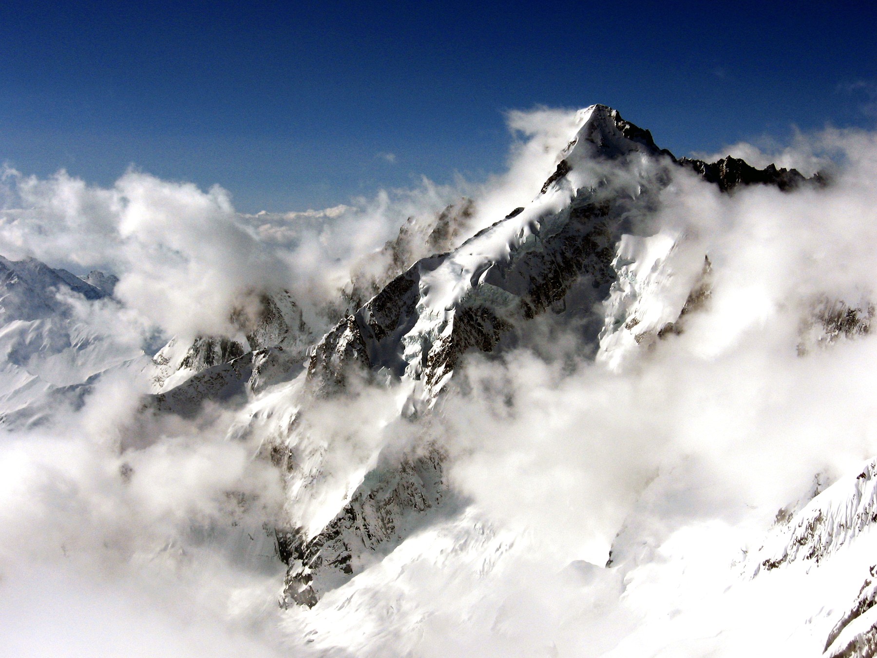
The 'painful mountain' — a small pyramidal summit standing at the meeting point of France, Italy and Switzerland (the only true tripoint on the international watershed of the Alps). Climbed on 7 July 1864 by Whymper's party on the same Dauphiné–Alps tour that took in Barre des Écrins ten days earlier; it was the last summit of that highly productive trip. The name dolent has been variously read as 'sore' (French dolent) or as a corruption of an old Aosta dialect word for 'peak'; both etymologies are still argued in local sources.

Location

Summit · huts that serve as bases for routes on this peak

Major routes
S flank from Bivacco Fiorio (Normal route)
PD · peu difficileTopo ↗
Vertical / summit day1,750 m gain · 4h
The standard line from Italy. From the Val Ferret (Arnouva) the approach climbs to Bivacco Fiorio (2724 m); summit day ascends the Pré-de-Bar glacier (45° max) to the SE ridge, finishing on a short exposed snow crest to the airy tripoint summit.
Sections
Arnouva (1769 m)Bivacco Fiorio (2724 m)+955 m4h
Bivacco FiorioSummit (4032 m)+1,308 m4h
Huts on this route
N ridge from Refuge d'Argentière (technical alternative)
D · difficile
Vertical / summit day1,300 m gain · 8h
A serious snow-and-mixed ridge from the French side. Sustained 50–55° snow with mixed sections (III); committing, with serac hazard on the upper face. Much harder and less popular than the Italian normal route.
Huts on this route
Nearby huts
Bivacco FiorioCAI · unguarded (always open)2,724 mRefuge d'ArgentièreCAF · mid-March to mid-September2,771 mCabane de l'A NeuveSAC · mid-March to late September2,735 mBivouac du Dolent-La MayeSAC · unstaffed (year-round access)2,667 m